Every Trip You Take: How Bike-Share Ride Data Is Quietly Reshaping American Cities
Photo: Our World in Data, CC BY 4.0, via Wikimedia Commons
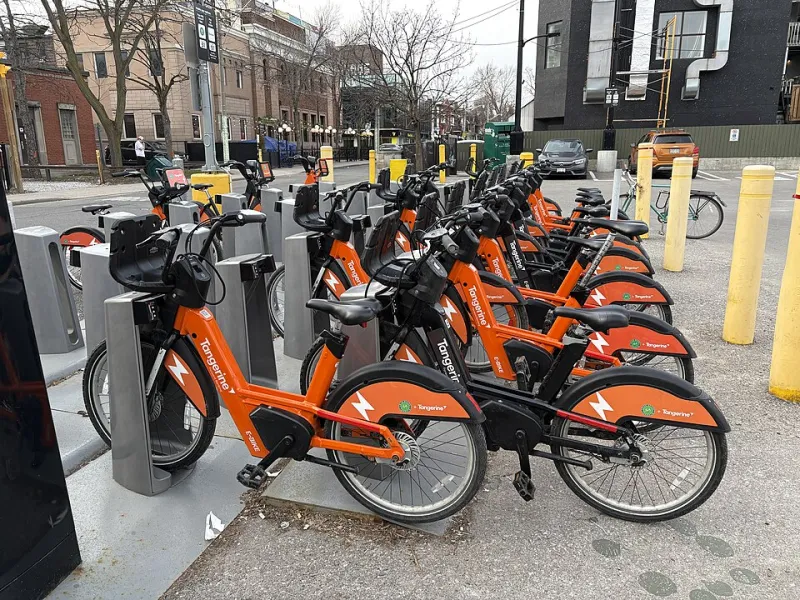
You unlock a bike at 8:14 AM, ride six blocks to your office, and dock it before grabbing your coffee. Simple enough. But somewhere in a server room — or more likely, a cloud cluster — that six-block trip just became a data point. Multiply that by millions of rides across hundreds of American cities, and you've got something that looks a lot less like a commute log and a lot more like a living map of how urban America actually moves.
Bike-share companies have quietly become some of the most sophisticated urban data collectors in the country. And the cities partnering with them are only now beginning to understand what that information is worth.
The Data Underneath the Ride
Every bike-share trip generates a surprising amount of raw information: start and end locations, trip duration, time of day, day of week, and in many systems, the route taken. When you aggregate that across an entire city — say, Chicago's Divvy network logging over 5 million rides annually, or New York's Citi Bike surpassing 30 million trips in a single year — the patterns that emerge are strikingly detailed.
"What we're really capturing is desire lines," explains one urban data scientist who consults with multiple municipal transit agencies. "Where people want to go, when they want to go there, and what routes they naturally choose when they're not constrained by car infrastructure. That's incredibly valuable for planning."
Desire lines — the paths people actually take versus the ones planners assume they'll take — have long been a holy grail for city designers. Traditionally, they were inferred from pedestrian wear patterns on grass or manual traffic counts. Now, bike-share data delivers them in real time, at scale, and with a level of granularity that would've required years of expensive fieldwork a decade ago.
From Rides to Road Decisions
Several American cities have already started translating ridership data into tangible infrastructure changes. In Seattle, analysis of bike-share trip clusters helped identify a stretch of roadway where cyclists were consistently taking longer, less direct routes — a signal that the more obvious path felt unsafe. The city used that insight to prioritize a protected lane project that had been languishing in the planning queue.
In Washington, D.C., Capital Bikeshare data has been incorporated into broader transportation modeling efforts, helping planners understand how cycling fits into multimodal commutes — particularly around Metro station access. When ridership spikes near a transit hub at the same time bus frequency drops, that correlation tells a story about service gaps that rider surveys alone might miss.
City planners are also using bike-share data to make the case for investment. Hard numbers on trip volume, peak demand windows, and underserved corridors carry weight in budget conversations that anecdotal advocacy simply can't match. "It moves the conversation from 'cyclists want this' to 'here's demonstrated demand,'" says one transportation planner working in the Midwest. "That's a different political conversation entirely."
The Equity Problem Hidden in the Numbers
Here's where things get complicated. Bike-share data is only as representative as bike-share ridership — and in most American cities, that ridership skews heavily toward wealthier, whiter, and more central neighborhoods. If planners use trip data to guide infrastructure investment, they risk doubling down on areas that already have robust cycling culture while systematically underinvesting in communities where bike-share hasn't yet taken hold.
"Data-driven planning sounds neutral, but it isn't," cautions a policy researcher focused on transportation equity. "If your dataset reflects existing inequality, your decisions will too. You need to actively correct for that, not just follow the numbers."
This is a real tension. The neighborhoods generating the most bike-share trips often don't need the most help. The neighborhoods that could benefit most from improved cycling infrastructure — lower-income areas, communities of color, places with higher rates of car-free households — frequently have fewer stations, lower ridership, and therefore less data representation. Using trip volume alone as a planning signal can quietly perpetuate the same disparities that made those communities underserved in the first place.
Some operators are starting to grapple with this directly. Lyft's Citi Bike program in New York has made commitments to expanding into outer-borough neighborhoods, and several cities have experimented with subsidized membership programs to broaden the rider base. But advocates argue these efforts need to move faster and go deeper — and that equity considerations should be baked into data analysis methodologies, not treated as an afterthought.
Privacy in the Peloton
Then there's the privacy question, which is thornier than it might initially seem. Most bike-share companies are quick to note that trip data is anonymized before it's shared with city partners or researchers. Individual riders aren't identified. But anonymization has limits.
"If I know someone bikes from a specific residential block to a specific office building every weekday morning, I can make some reasonable inferences about who that person is, even without a name attached," notes a digital privacy advocate who has reviewed data-sharing agreements between cities and mobility operators. "Location data is inherently personal. The bar for what counts as 'anonymized' needs to be a lot higher than the industry currently sets."
There's also the question of what happens to that data downstream. City contracts with bike-share operators vary widely in how they govern data retention, third-party sharing, and commercial use. In some cities, the agreements are robust and public-facing. In others, they're opaque. Riders in most cases have no meaningful way to opt out of trip data collection, and few have any visibility into how their aggregated movement patterns are being used.
This isn't unique to bike-share — ride-hailing apps, transit payment systems, and even parking meters collect comparable data. But as bike-share networks expand and their data becomes more commercially valuable, the governance frameworks need to keep pace.
What Good Data Stewardship Actually Looks Like
The good news is that some cities are getting this right. Minneapolis has developed a Mobility Data Specification framework that standardizes how trip data is collected and shared, giving the city more control over how the information is used. Los Angeles has been a national leader in pushing for open data standards that make mobility information accessible to researchers and advocates — not just government agencies and corporate partners.
The key, according to planners and advocates who've worked on these issues, is treating bike-share data as a public resource rather than a proprietary asset. That means transparent data-sharing agreements, community input into how trip patterns are interpreted and acted upon, and explicit equity overlays that prevent planning decisions from simply following existing demand.
The Grid Knows Where You're Going
There's something genuinely exciting about the idea that millions of everyday cycling trips are building a smarter, more responsive city. When your morning commute helps a planner identify a dangerous intersection, or your weekend ride adds evidence to the case for a new protected lane, that's collective action in a form most people never think about.
But that promise only holds if the systems governing that data are designed with the public interest at their core — not just the interests of the riders who already show up in the numbers. The bike-share grid is only as good as the values embedded in the people who read it.
Ride thoughtfully. The city is paying attention.